Railway Flood Risk Mapping
Development of flood risk maps for railway tracks in nationwide floodplain areas using digital surface models and machine learning
The Challenge: When Railways Meet Monsoons
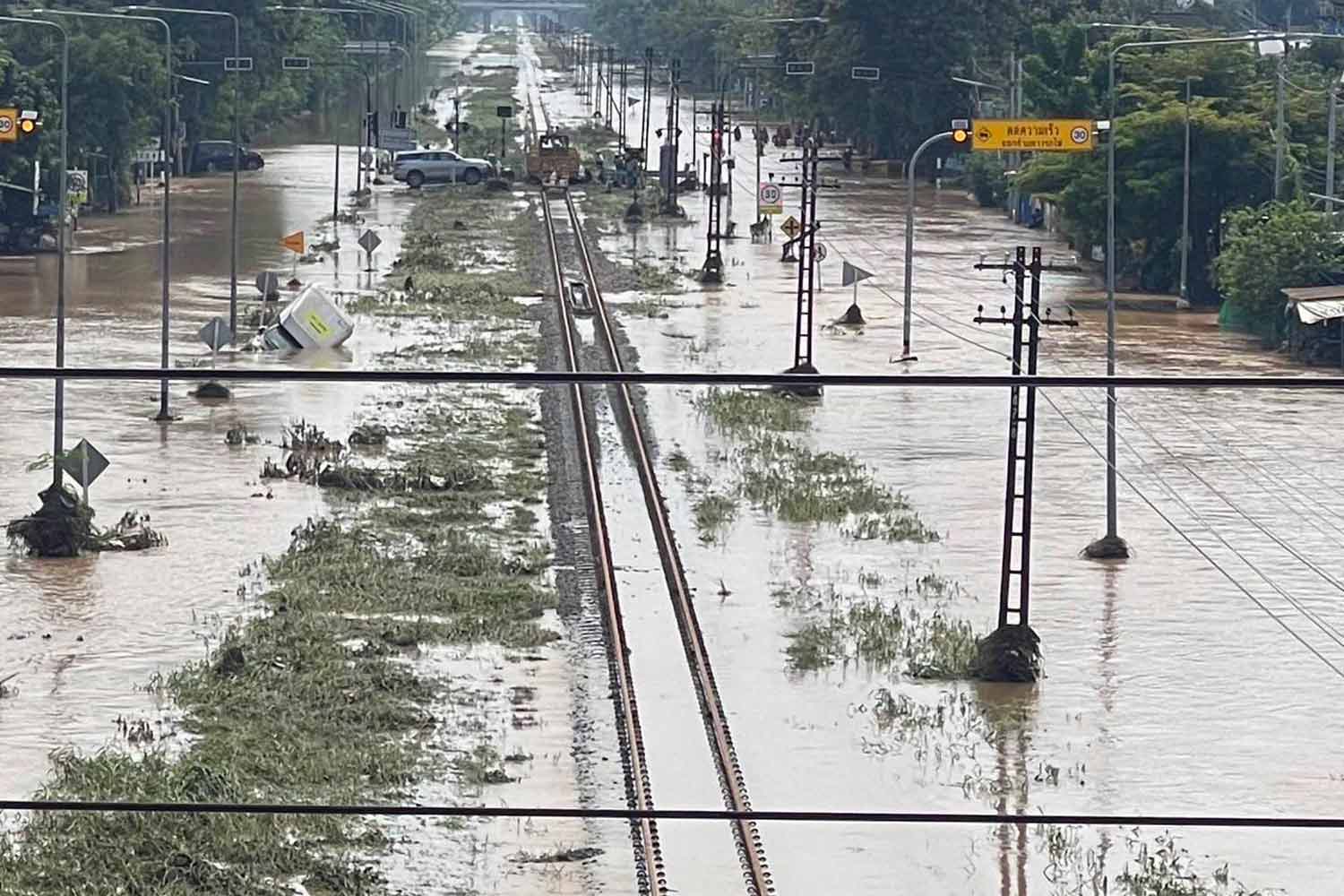
In Thailand’s monsoon-prone regions, railways face a perpetual battle against nature. Heavy rainfall events frequently lead to flooding, disrupting critical transportation infrastructure and causing significant economic losses. Add human activities like railway embankments that obstruct natural water flow, and you’ve got a perfect storm of flood risk factors.
Our Innovative Approach
Our research tackles this complex challenge by combining advanced computer vision techniques with machine learning to create a comprehensive flood risk assessment system for railway infrastructure. We integrated:
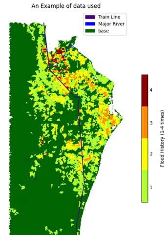
- Digital Surface Models (DSM) for precise topographical mapping
- Historical climate data spanning 12 years (2005-2016)
- Machine learning classification to predict flood risk levels
- Operation-based Flood Risk Index (FRI) to translate predictions into actionable guidance
Methodology: From Data to Decisions
1. Data Collection & Oversampling
We collected data on four major risk factors in railway track flooding:
- Historical climate conditions
- Drainage basin characteristics
- Slope gradient analysis
- Elevation mapping
Due to the natural imbalance in our dataset (most locations don’t flood most years), we implemented Adaptive Synthetic Minority Oversampling Technique (ADASYN) to ensure our models weren’t biased toward predicting “no flood” as the default outcome.
2. Operation-based Flood Risk Index
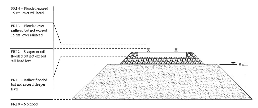
We developed a practical Flood Risk Index (FRI) based on real-world railway operations during floods:
| FRI | Range | Level of flood | Interpretation |
|---|---|---|---|
| 0 | No flood | No risk | Normal operations |
| 1 | 0-30 cm | Ballast level - Sleeper bottom | Caution advised |
| 2 | 31-60 cm | Sleeper bottom - Railhead | Reduced speed required |
| 3 | 61-70 cm | Over railhead | Minimal operations only |
| 4 | >70 cm | Severe flooding | No operations permitted |
3. Machine Learning Magic
We tested several machine learning models and found that the Extra Trees classifier performed best, achieving:
- 98% accuracy on training data
- 71% F1-score on test data (2015-2016)
- Excellent performance in identifying areas at risk of flooding
Results: From Prediction to Prevention
Our model successfully:
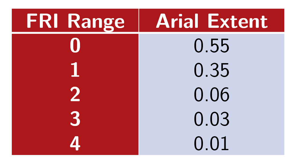
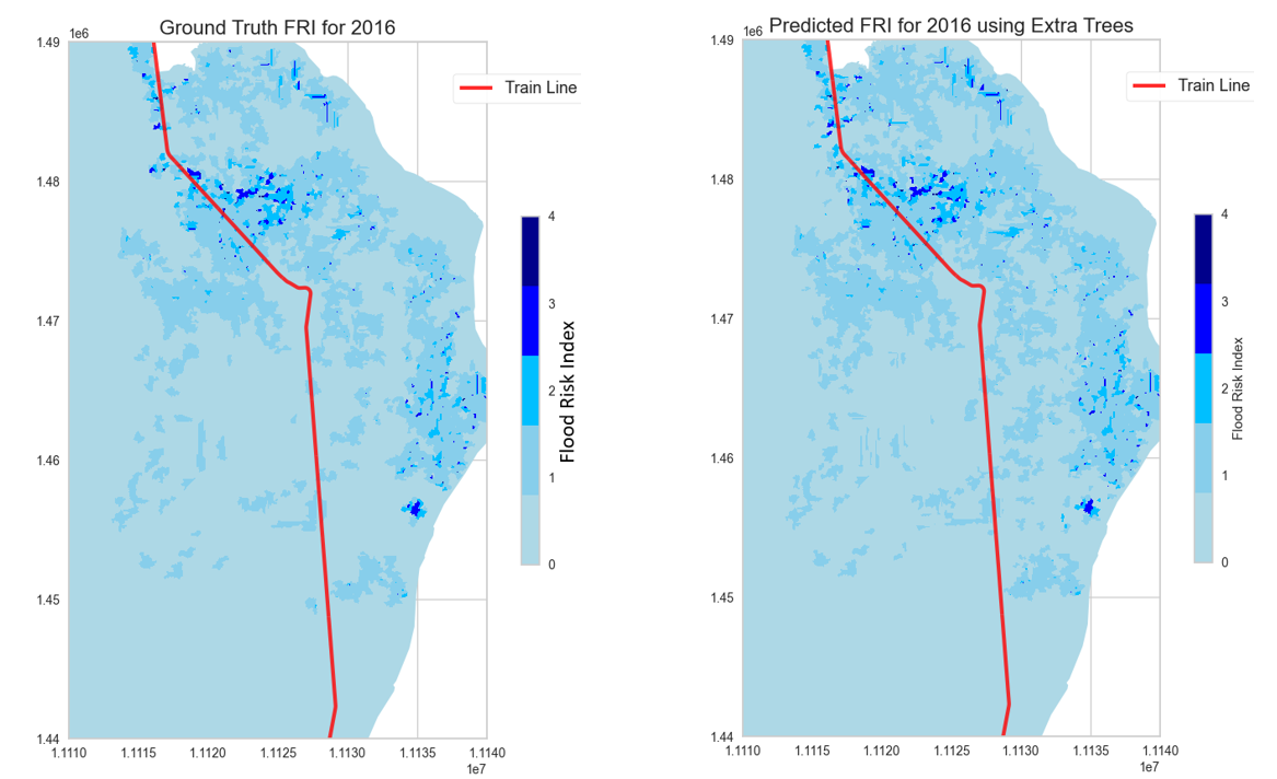
- Generated detailed flood risk maps for railway tracks across Thailand
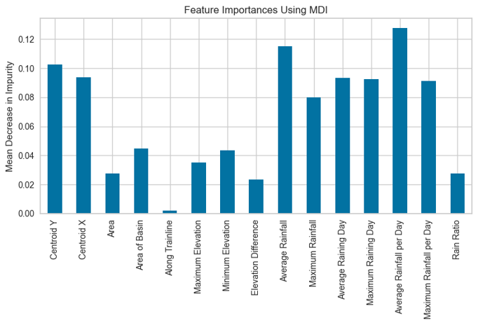
- Identified the three most influential flooding factors:
- Average rainfall
- Average rainfall per day
- Maximum rainfall per day
- Provided actionable insights for railway operators to make evidence-based decisions
Real-World Impact
This research has profound implications for:
- Infrastructure planning: Identifying high-risk areas for prioritized flood mitigation
- Operational protocols: Setting evidence-based speed restrictions during flood events
- Disaster prevention: Enabling proactive measures before flooding occurs
- Climate resilience: Building railway systems that can withstand increasingly extreme weather events
The Team
This project represents collaborative work across multiple disciplines and institutions:
- Watcharapong Wongkaew - Chulalongkorn University Transportation Institute
- Kittipat Phunjanna - The Chinese University of Hong Kong, Department of Electronic Engineering
- Wachira Muanyoksakul - Advanced Railway Infrastructure, Innovation and Systems Engineering (ARIISE) Research Unit
- Tanawat Tangjarusritanatorn - Department of Water Resources Engineering, Chulalongkorn University
- Chayut Ngamkhanong - ARIISE Research Unit, Department of Civil Engineering
Looking Forward
The methodologies developed in this project can be applied to other regions facing similar challenges, helping create more resilient railway infrastructure worldwide. As climate change continues to increase the frequency and severity of extreme weather events, these predictive tools will only become more valuable.
Would you like to learn more about this research or explore potential applications? Contact us for more information!